 ROUTE
ROUTE
ROUTE
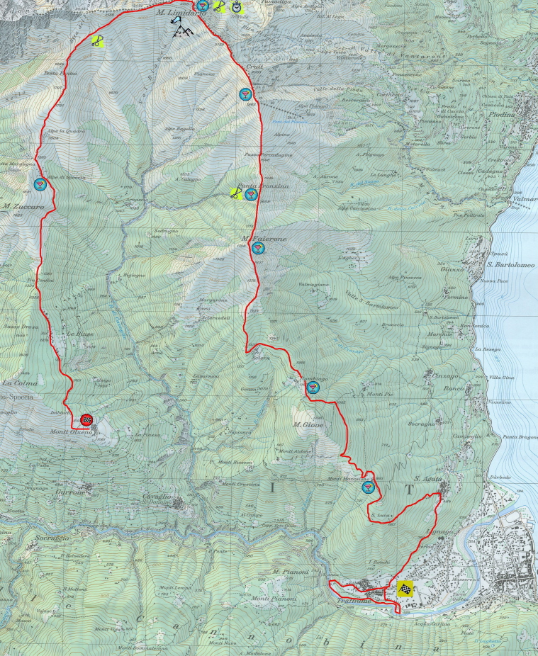
Start line from Cannobio locality Traffiume (250 meters a.s.l.) and Finish at locality “Monti di Olzeno” (1200 metres a.s.l) in Cannobina valley.
22 Km with a total climbing up difference in height of about 2200 metres, and 1300 metres going down. After a 2 Km plain running along the side of the Cannobino stream, the race faces
the demanding mule-track which goes through chestnuts woods and leads to Mt. Giove slopes. A 1 Km false plain takes to the technical and agonistic heart of the race: a wonderful and
selective ride on crests with fabulous views of Lake Maggiore, running on paths that go towards Mt. Fairone top (1715 m a.s.l.), Fronzina ramp and the Torrino, and getting to
Mt. Limidario top cross (2188 m a.s.l.) in Switzerland. From here on, 6 Km going down hill and passing underneath the spectacular Gridone rocks and, after passing through a gorgeous beech
wood, reaching Olzeno mountains locality (1060 m a.s.l.).
![]()
To enlarge clck on the picture
![]()